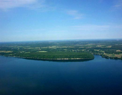
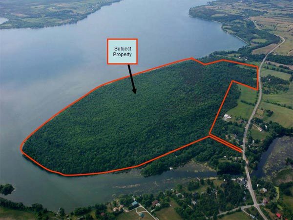
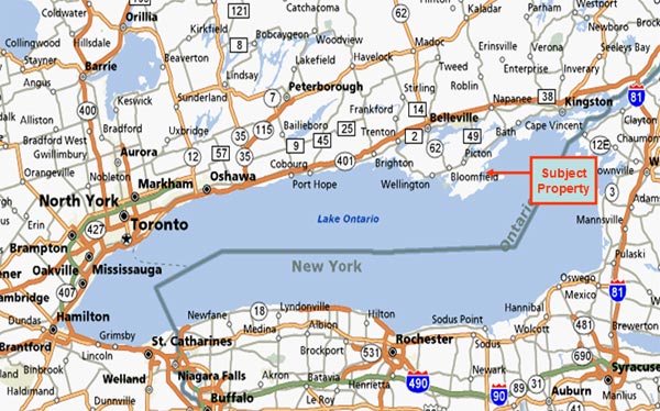
The property is located in the south east quadrant of Prince Edward County, Ontario, approx 200km east of Toronto and approx 60km west of Kingston. It is 241 acres in size, has in excess of 6,400 ft of Water frontage, of which over 5,000ft is on Lake Ontario, the balance being on the Black River. The property also has over 1,000 ft frontage on county road 13, a paved public road.
The property is generally wooded, has a gentle upslope from the road on the west side culminating into a significant two tiered Bluff on the east side, offering exquisite building sites and spectacular views of Prince Edward Bay and Lake Ontario.
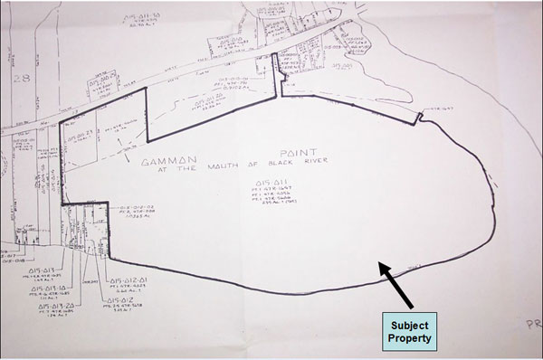
Legal Description
Part of Gammon Point at the mouth of Black River, Concession Round Prince Edward Bay, Part of Lot 28, being Part 1 on Plan 47R-5606, Part 1 on Plan 47R-4056 and Part 1 on Plan 47R-4716, Township of South Marysburgh, County of Prince Edward, being 241 acres more or less.
Zoning
Zoning is mostly Environmentally protected as a result of the “ANSI” (Area of Natural and Scientific Interest) designation due to rare and semi rare flora present on the property. This designation does not preclude development, however any proposal is subjected to a higher degree of scrutiny and generally limited to lower density. A small portion of the property is zoned Rural.
Download Ansi Def. (PDF) of McMahon Bluff
Taxes
Current property taxes are in the range of $ 5,000 per year.
Access to the Property
The property can be accessed from Toronto (the west), via Hwy 401 in less than 2 hours. From Kingston (the east) , the property can be accessed via Hwy 401 as well as via Hwy #2, using the Glenora ferry. It will take approx 1.5 hours via either of these two routes. The nearest full service, jet capable airport is Trenton Air Force Base (requires prior landing permission) , or Kingston.
Prince Edward County is located on a large irregular headland or littoral at the eastern end of Lake Ontario, just west of the head of the St. Lawrence River. This headland (officially named Prince Edward County in 1792) is surrounded on the north and east by the Bay of Quinte; as the Murray Canal now connects the bay to Lake Ontario across the only land connection, the county could technically be considered an island.
According to the 2006 Census, Prince Edward has a population of 25,496 over an area of 1050.14 square kilometers.
The county's relatively mild climate due to the influence of Lake Ontario, has led to the establishment of about 50 vineyards and close to a dozen wineries. The influence of Lake Ontario, also results in heavier snowfall than surounding counties.
Welcome to this unique island community, a place of tranquility, creativity, hospitality and fun. Prince Edward County residents are proud of their United Empire Loyalist roots and distinctive towns and villages. They generously share the spectacular natural beauty of the County with over 100,000 visitors each year. Traditional agriculture is the backbone of the area, enhanced by a growing wine industry. The unique ‘County’ culture is enhanced by many artists and artisans making this their home.
The County was created by Upper Canada’s founding lieutenant-governor John Graves Simcoe July 16, 1792 and named after Prince Edward Augustus, Duke of Kent (the fourth son of King George III) who was commander-in-chief of British North America and the father of Queen Victoria.
Some of the earliest United Empire Loyalist settlements in Ontario were set up here shortly after the American Revolution. The County was originally composed of three townships named in honour of three of George III’s daughters: Ameliasburgh, named after Princess Amelia; Marysburgh, named after Princess Mary; and Sophiasburgh, named after Princess Sophia.
In 1998, all of the former municipalities in Prince Edward County amalgamated to form a single-tier municipality as part of province-wide municipal restructuring.