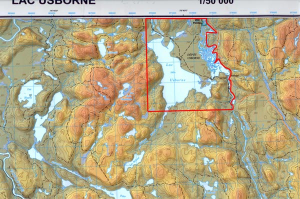
Legal Description
Property of Lake Usborne
Part of Block A, Plan 7086
Township of Gillies, MRC of Pontiac
Province of Quebec
Zoning
Current zoning is recro touristique and touristique. Although current zoning already allows subdividing into smaller parcels, the municipality is not adverse to any sound proposal, including commercial development.
Timber and Mineral rights
All timber rights are included in the sale, all mineral rights are excluded as they belong to the crown.
Current value of Timber
The value of the timber currently standing on the property has been estimated to be well in excess of $1 million under current market conditions.
Taxes
Total property taxes approx $10,000.00 per year.
Access
Via public road or float plane.
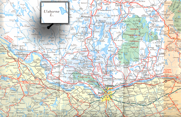
The property is located approx 115 km ( 71 miles ) straight north of Downtown Ottawa. The first one half of the trip is on paved road, the balance is on a gravel road reasonably well maintained by public road department.
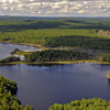
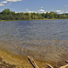
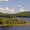
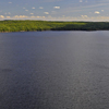
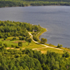
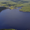
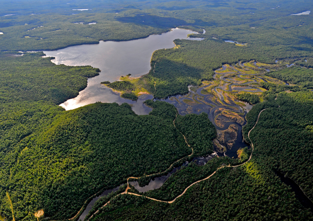
Usborne Lake
Usborne Lake is completely private, is approx 400 hectares (1,000 acres) in size, approx 24 meters (80 ft) deep and has a shoreline of approx 16km ( 10 miles )
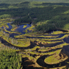
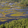
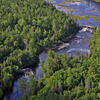
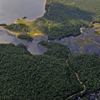
East Coulonge River
East Coulong River forms the boundary on the east side of the property, south of Dam, approx 2km (1.2 miles) and north of Dam river meander, straight line approx 5.6 km ( 3.5 miles )
The Coulonge River is a predominantly wilderness river in western Quebec, Canada. It is 217 km long, has a drainage area of 5060 square kilometres (source:Atlas of Canada), and runs in a general south-eastern direction from its headwaters in Lac au Barrage (situated in what is now La Vérendrye Wildlife Reserve) to the Ottawa River at Fort-Coulonge, Quebec. Over that distance, it drops approximately 260 meters, 48 meters of that over the massive Grandes Chutes, approximately 15 kilometers upstream of the confluence with the Ottawa River.
A popular river for whitewater canoeing enthusiasts, it is often grouped together with the Dumoine and Noire Rivers as three of a kind. The three rivers share the same watershed, and have similar whitewater characteristics. All three empty into the Ottawa River within a distance of 105 kilometers from one another.
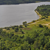
Buildings
There are still three old cottages on the east shoreline of the lake, these buildings have essentially no value.
Fish
Usborne Lake: Lake Trout, Walleye, Bass, Pike, Muskellunge, Perch.
Coulonge River: Bass, Muskellunge, Pike, Sturgeon, Rainbow Trout.
Wildlife
Moose, Bear, Deer, Wolf, Coyote, Fox, Wolverine, Fisher, Small Game, Waterfowl.
Area Population
Pontiac is a county regional municipality in the Outaouais region of Quebec, Canada. Population: 14,586 in 2006, up 0.1 % from 2001.
Language
The Pontiac MRC is primarily but not overwhelmingly anglophone; in the Canada 2006 Census, 56.7 % identified English as their first language, 41.1 % said it was French, 0.8 % listed both, and 1.4 % listed other.
A Dam belonging with the property is located on the river approx one third north of the south boundary and two thirds south of the north boundary, just south of where the river meanders terminate.
A Dam was originally built to control water flow on the river to allow floating of logs from its 970 sq km watershed. In later years, the dam was rebuilt to its present state, but is now only used to help control water flow for a hydro electric generating plant downstream on the Ottawa river.
The dam is leased and maintained by "Company d'Estacades des Rivieres Coulonge & Crow Ltee" for a modest sum of approx $600.00 per year. For further details, please see the complete Dam Lease.
With its height differential of 6.5 meters, the Dam would lend itself very well to add a small hydro electric generating unit to power any development around the lake, or even to sell electricity into the grid. However, the lack of any nearby transmission line seems to be a serious financial impediment for such an undertaking. Please see hydro electric study on separate page.
Public hydro service is approximately 30 km away.
Please see the Hydro Electric Study.
The Coulonge River is named after Nicholas d'Ailleboust, Sieur de Coulonge, who established a trading post at the mouth of the river in the winter of 1694-95, thereby establishing the first permanent European settlement in the Pontiac region of West Quebec.
One of a dozen or so significant tributaries of the Ottawa River, the Coulonge was used as a waterway by native North Americans and, later, by the coureur des bois plying their independent trade in furs. In 1835, Scottish-born lumber baron George Bryson acquired timber rights to thousands of acres of forest in the area, including the 200 acres immediately surrounding the Grandes Chutes. To transport the squared timber safely past the falls and the 750 meter gorge below, Bryson built a kilometer-long timber slide (a wooden chute flowing with water diverted from the head of the falls) to the calmer waters near the confluence of the Coulonge and Ottawa rivers.
For almost 150 years, the forests around the Coulonge were logged throughout the winter months until spring breakup permitted the massive log drives which, along with similar operations throughout the Ottawa River watershed, fueled the economy of the Ottawa Valley region from the early 19th century through the middle of the 20th.
The last spring log drive in Canada took place on the Coulonge River in 1982. Since then, the timber from smaller-scale logging operations has been hauled out by trucks over a network of dirt roads which meander throughout the Coulonge River valley.
Click on an image to see the larger version of the image.